 http://www.pmel.noaa.gov/maillists/tmap/ferret_users/fu_2007/msg00384.html
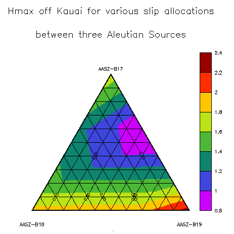
This is a triangular plot map of maximum humidity on the island of Kauai. A triangular plot is a barycentric plot of three variables that add up to a constant. This plot demonstrats the maximum humidity experienced off the coast of Kauai. Notice that there is a low humidity area between AASZ-B19 and AASZ-B17. Enjoy!!
No comments:
Post a Comment