 http://www.geo.utexas.edu/faculty/barker/kempter/rbtephra.html
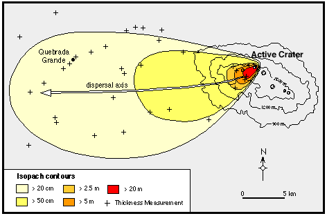
This is a measurement of thickness. This measures the thickness of ash deposited from the volcanic eruption on the land. This image demonstrates that most of the deposits are deposited near the volcanic eruption. This is an Isopach map because it has lines connecting equal value of thickness.
Enjoy!!
No comments:
Post a Comment